Havilah Copper-Gold
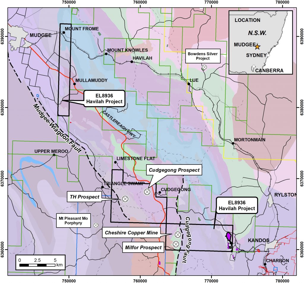
The Havilah Project (EL8936) consists of three granted tenement blocks with an area 102km2 (Figure 4). The project predominantly covers Silurian and Devonian sediments and volcanics of the Hill End Trough to the west of the Wiagdon Thrust/ Mudgee Fault. In the southern block of EL8936 there is a belt of Ordovician Sofala Volcanics. Ordovician to early Silurian volcanic and intrusive rocks of the Macquarie Arc host several major deposits including North Parkes, Lake Cowal and Cadia/Ridgeway.

Figure 4: EL8936 Location Plan – Havilah Project showing main prospect areas. Ordovician basic volcanic and basic intermediate intrusives are shown in green

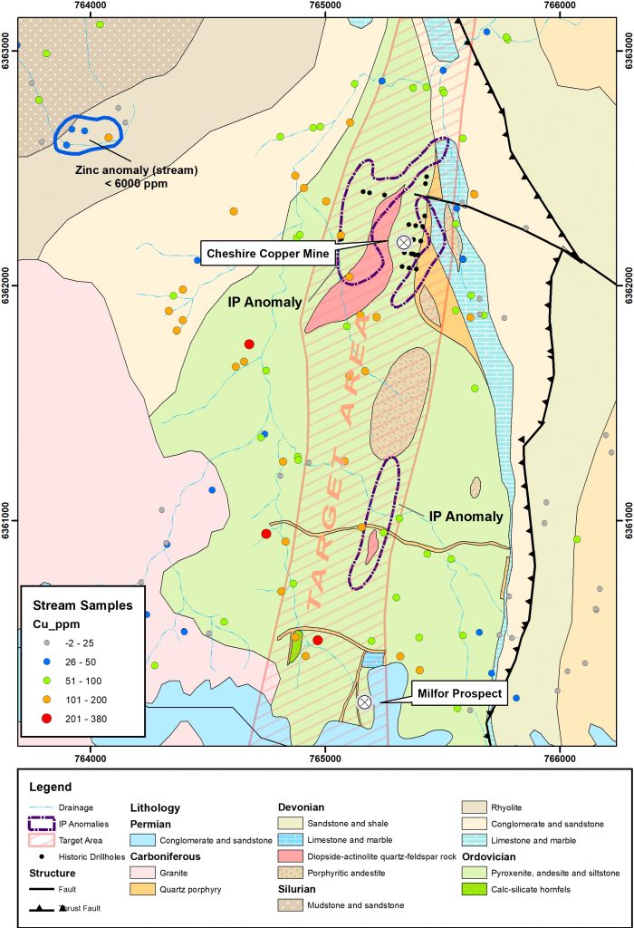
Figure 5: Geology plan Cheshire Copper Mine – Milfor prospects showing previous drilling, IP anomalies and stream sediment sample results
The Cheshire Copper Mine comprises several shafts, workings and an old brick kiln. Copper mineralisation is spatially related to a shear up to 2m wide close to the contact between andesite and rhyolitic volcanics. At the Milfor prospect 1.4km to the south there is a group of workings that have exploited disseminated and veined copper mineralisation in andesite. The prospect was discovered by regional stream sediment sampling with anomalous copper values covering an area of 2.5km by 1km. Follow up soil sampling confirmed an anomalous trend between the Cheshire Mine and Milfor prospect. A subsequent induced polarisation survey located several chargeability anomalies coincident with exposures of diopside-actinolite skarn (Figure 5). A 20 hole percussion drilling program was conducted at the Cheshire Mine by Mt. Hope Minerals NL in 1973 with holes drilled to a maximum depth of only 21.3m. PDH001 intersected a best result of 3m at 1.45% Zn, 0.1% Cu from 12.2m and PDH009 intersected 4.5m at 0.29% Zn, 0.12% Cu from 6.1m. The holes were not assayed for Gold.
There has been no additional drilling or effective exploration at the Cheshire Mine-Milfor prospect since the 1970s. Golden Deeps plans to conduct systematic exploration of the geochemical and geophysical anomalies within the Ordovician volcanics commencing with 2km x 3km grid-based soil sampling programme. Priority targets generated will be tested with RAB/RC drilling. The Milfor prospect and some of the IP anomalies overlying skarn rocks have not been drilled previously.

